By Rosemary Bailey
This article was originally published in the August 2018 edition of Soul Search, the journal of The Sole Society
Historical photo-mapping web app Timepix has launched with 26,000 photographs available for Greater Manchester in the 1940s and 1950s.
If you had relatives in the area www.timepix.uk is well worth a visit. Try a search for surname or street name, or just zoom into the map to look at an area of interest.
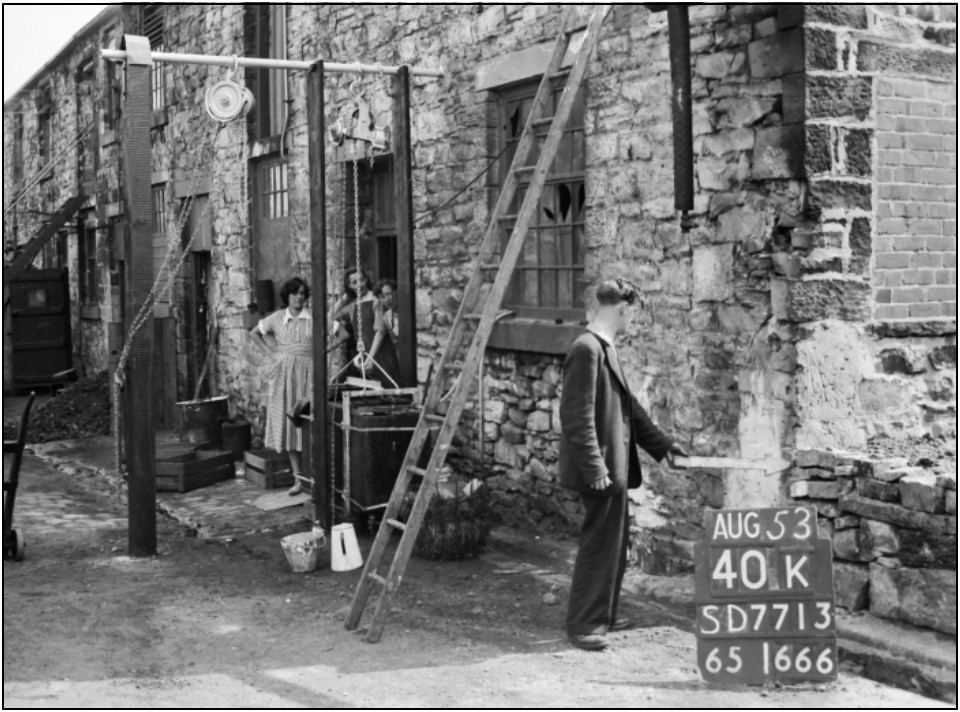
These photos were taken as part of a detailed post-war survey by Ordnance Survey and show a fieldworker using a white arrow to point to a specific spot, and a ‘hymn board’ giving information. The positions chosen were often on street corners and capture shops, pubs and sometimes children and other passers-by.
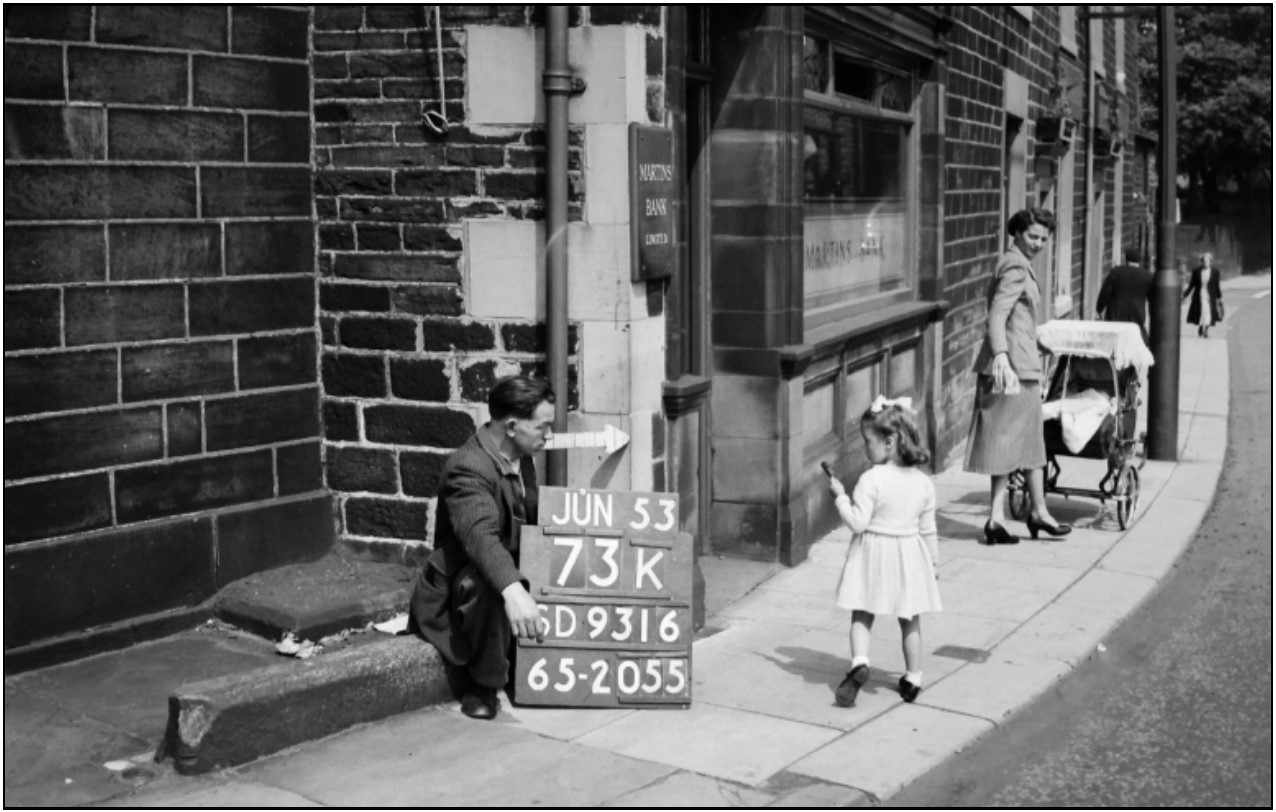 Image of Manchester street corner showing location board and arrow.
Image available on the Timepix site
Select ‘Change Map’ to display the 1890s Ordnance Survey map and you will see those streets as they were prior to modern development, and when the railway network was at its height.
Timepix is loading up to 1000 historical photographs each week to complete the 46,000 strong Manchester Archives+ collection of OS photos and the numbers of images for other parts of Great Britain will also increase soon. Low resolution photos can be used freely and copies purchased from £6.99.
1890s map and photos on the move
Timepix is designed to be used when out and about on family history travels, so when you first visit www.timepix.uk on a mobile or tablet, accept the offer for a bookmark to be added to your home screen. Choosing ‘Locate Me’ will display photos for wherever you are. Toggle to explore the 1890s map for that location. You can sign up for updates at www.timepix.org